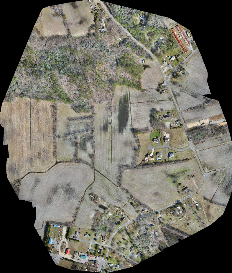
Solutions IPEM provided Aerial Photography for Digital Topographic Mapping, creating a base map for Civil Engineering plans.